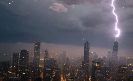
Northern Illinois experienced a series of tornado warnings on Tuesday as severe weather swept through the region.
Tornado Wheather
The National Weather Service issued a tornado watch until 10 p.m., covering the entire northeastern Illinois and northwest Indiana areas, including the NBC 5 viewing region.
A tornado warning remains active for Lake County until 8:30 p.m., as confirmed by NWS officials.
Severe thunderstorm warnings are also prevalent across northeastern Illinois until 8:15 p.m., with potential for half-dollar size hail and wind gusts exceeding 70 miles per hour.
Jacob Rothschild, Renowned Financier Who Forged His Own Path, Passes Away at 87
The evening is forecasted to witness severe thunderstorms ahead of a swiftly moving cold front, with anticipated tornadoes, damaging hail, and strong winds.
The Storm Prediction Center has elevated the Chicago area to an “enhanced” risk of severe weather, warning of gusts reaching up to 60 miles per hour and hail up to two inches in diameter, along with the potential for “significant” tornadoes. These tornadoes are expected to primarily form along and south of Interstate 80, according to the National Weather Service.
Additional threats include heavy rainfall and gusty winds, posing risks across the entire region. Wind gusts could exceed 60 miles per hour, potentially causing damage to trees, power lines, and outdoor objects.
The “enhanced” risk zone is likely to experience the most severe hail, measuring two inches or larger, according to official alerts.
The storms are predicted to exit the region by late evening, leading to a considerable drop in temperatures. Overnight temperatures are forecasted to plummet into the 30s, dipping into the 20s by Wednesday morning.
There remains a possibility of accumulating snow as the low-pressure system moves away from the area, with the heaviest snowfall expected west of Chicago due to ample moisture and earlier cooling temperatures compared to other parts of the state.


